Fayl:Pomorskie mapa fizyczna.png
Size of this preview: 771 × 600 pixels. Başqa çözüm: 309 × 240 pixels | 617 × 480 pixels | 987 × 768 pixels | 1.280 × 996 pixels | 2.254 × 1.754 pixels.
Kerçek fayl (2.254 × 1.754 piksel, fayl büyükligi: 743 KB, MIME çeşiti: image/png)
Faylğa ait qısqa tarif
| Tasvir |
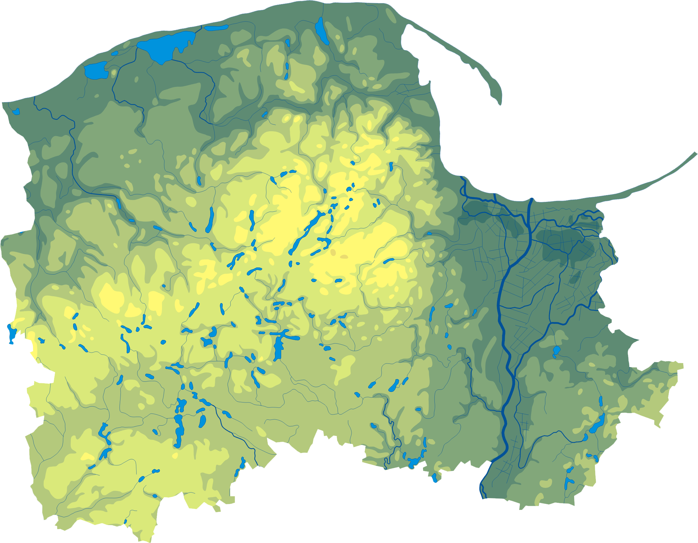
Polski: Mapa wód i ukształtowania powierzchni województwa pomorskiego. Autor: Aotearoa Współrzędne graniczne mapy:
Legenda |
| Tarih | 29 avgust 2006 (original upload date) |
| Menba | Transferred from pl.wikipedia to Commons by Przykuta. |
| Yaratıcı | Aotearoa at Polish Vikipediya |
| Other versions | Derivative works of this file: Wikiekspedycja trasa Bory Tucholskie.png |
Litsenziyalama
Aotearoa at Polish Vikipediya, the copyright holder of this work, hereby publishes it under the following license:

|
Permission is granted to copy, distribute and/or modify this document under the terms of the GNU Free Documentation License, Version 1.2 or any later version published by the Free Software Foundation; with no Invariant Sections, no Front-Cover Texts, and no Back-Cover Texts. A copy of the license is included in the section entitled GNU Free Documentation License. |
| This file is licensed under the Creative Commons Attribution-Share Alike 3.0 Unported license. | ||
| Attribution: Aotearoa at Polish Vikipediya | ||
| ||
| This licensing tag was added to this file as part of the GFDL licensing update. |
Original upload log
The original description page was here. All following user names refer to pl.wikipedia.
- 2006-08-29 18:31 Aotearoa 471×363× (99032 bytes) Mapa wód i ukształtowania powierzchni województwa pomorskiego. Autor: [[Wikipedysta:Aotearoa|Aotearoa]]
Faylnıñ keçmişi
Faylnıñ kerekli anki alını körmek içün tarihqa/saatqa basıñız.
| Tarih ve saat | Kiçik resim | En × boy | Qullanıcı | İzaat | |
|---|---|---|---|---|---|
| şimdiki | 10:56, 2012 s. oktâbrniñ 29 | | 2.254 × 1.754 (743 KB) | Aotearoa | drobne techniczne |
| 10:07, 2009 s. noyabrniñ 12 |  | 471 × 363 (97 KB) | Przykuta | {{Information |Description={{pl|Mapa wód i ukształtowania powierzchni województwa pomorskiego. Autor: Aotearoa == Legenda == 75px}} |Source=Transferred from [http://pl.wikiped |
Fayl qullanıluvı
Bu saife qullana bu fayldı:
Umumiy fayl qullanıluvı
Bu vikilerde bu fayldı qullana:
- be.wikipedia.org qullanım
- bg.wikipedia.org qullanım
- ce.wikipedia.org qullanım
- de.wikipedia.org qullanım
- es.wikipedia.org qullanım
- lv.wikipedia.org qullanım
- mk.wikipedia.org qullanım
- pl.wikipedia.org qullanım
- pt.wikipedia.org qullanım
- ru.wikipedia.org qullanım
- uk.wikipedia.org qullanım
- www.wikidata.org qullanım