Fayl:Ireland location map.svg

Size of this PNG preview of this SVG file: 481 × 599 pixels. Başqa çözüm: 192 × 240 pixels | 385 × 480 pixels | 616 × 768 pixels | 822 × 1.024 pixels | 1.643 × 2.048 pixels | 1.450 × 1.807 pixels.
Kerçek fayl (SVG faylı, nominal 1.450 × 1.807 piksel, fayl büyükligi: 938 KB)
Faylğa ait qısqa tarif
| Tasvir |
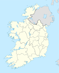
Deutsch: Positionskarte von Irland
Quadratische Plattkarte, N-S-Streckung 170 %. Geographische Begrenzung der Karte:
English: Location map of Ireland
Equirectangular projection, N/S stretching 170 %. Geographic limits of the map:
|
| Tarih | 01-07-2008 |
| Menba | own work, using United States National Imagery and Mapping Agency data |
| Yaratıcı | NordNordWest |
| Other versions |
DerivativeVersions |


|
This map has been made or improved in the German Kartenwerkstatt (Map Lab). You can propose maps to improve as well.
|
Litsenziyalama
I, the copyright holder of this work, hereby publish it under the following licenses:

|
Permission is granted to copy, distribute and/or modify this document under the terms of the GNU Free Documentation License, Version 1.2 or any later version published by the Free Software Foundation; with no Invariant Sections, no Front-Cover Texts, and no Back-Cover Texts. A copy of the license is included in the section entitled GNU Free Documentation License. |
This file is licensed under the Creative Commons Attribution-Share Alike 3.0 Unported license.
- Azatsıñız:
- paylaşuv – qopyaluv, dağıtuv ve iletüv
- remiks etüv – uyğunlaştıruv
- Bu şartlar astında:
- attribution – You must give appropriate credit, provide a link to the license, and indicate if changes were made. You may do so in any reasonable manner, but not in any way that suggests the licensor endorses you or your use.
- aynı şekilde paylaşuv – If you remix, transform, or build upon the material, you must distribute your contributions under the same or compatible license as the original.
İstedigiñiz lisansnı seçebilirsiñiz.
Faylnıñ keçmişi
Faylnıñ kerekli anki alını körmek içün tarihqa/saatqa basıñız.
| Tarih ve saat | Kiçik resim | En × boy | Qullanıcı | İzaat | |
|---|---|---|---|---|---|
| şimdiki | 06:45, 2020 s. iyülniñ 18 | | 1.450 × 1.807 (938 KB) | Chipmunkdavis | Adding toggle to display pre-2014 boundaries, adjusting some code for names and shape |
| 06:47, 2020 s. iyülniñ 11 |  | 1.450 × 1.807 (908 KB) | Chipmunkdavis | Overhauling code, together with code from File:Galway City in Ireland.svg (itself derived from this file), to be both simpler and more easily editable. All islands are now grouped with their mainland county, and counties are grouped into provinces. Groups exist for traditional counties where divided. | |
| 12:08, 2014 s. sentâbrniñ 12 |  | 1.450 × 1.807 (597 KB) | Ravenpuff | Retry that | |
| 11:57, 2014 s. sentâbrniñ 12 |  | 1.450 × 1.807 (597 KB) | Ravenpuff | Merged North Tipperary and South Tiperrary, Limerick and County Limerick, Waterford and County Waterford (Local Government Reform Act 2014) | |
| 18:04, 2009 s. sentâbrniñ 1 |  | 1.450 × 1.807 (598 KB) | NordNordWest | ||
| 19:08, 2008 s. avgustnıñ 25 |  | 1.450 × 1.807 (599 KB) | NordNordWest | size correction | |
| 18:13, 2008 s. iyülniñ 19 |  | 483 × 602 (581 KB) | NordNordWest | ||
| 14:13, 2008 s. iyülniñ 1 |  | 483 × 602 (554 KB) | NordNordWest | {{Information |Description= {{de|Positionskarte von Irland}} Quadratische Plattkarte, N-S-Streckung 170 %. Geographische Begrenzung der Karte: * N: 55.6° N * S: 51.2° N * W: 11.0° W * O: 5.0° W {{en|Location map of [[:en:Ireland|Ireland |
Fayl qullanıluvı
Bu 2 saifeler qullana bu fayldı:
Umumiy fayl qullanıluvı
Bu vikilerde bu fayldı qullana:
- af.wikipedia.org qullanım
- am.wikipedia.org qullanım
- ar.wikipedia.org qullanım
- arz.wikipedia.org qullanım
- ba.wikipedia.org qullanım
- be-tarask.wikipedia.org qullanım
- be.wikipedia.org qullanım
- bg.wikipedia.org qullanım
View more global usage of this file.