Fayl:Indonesia location map.svg

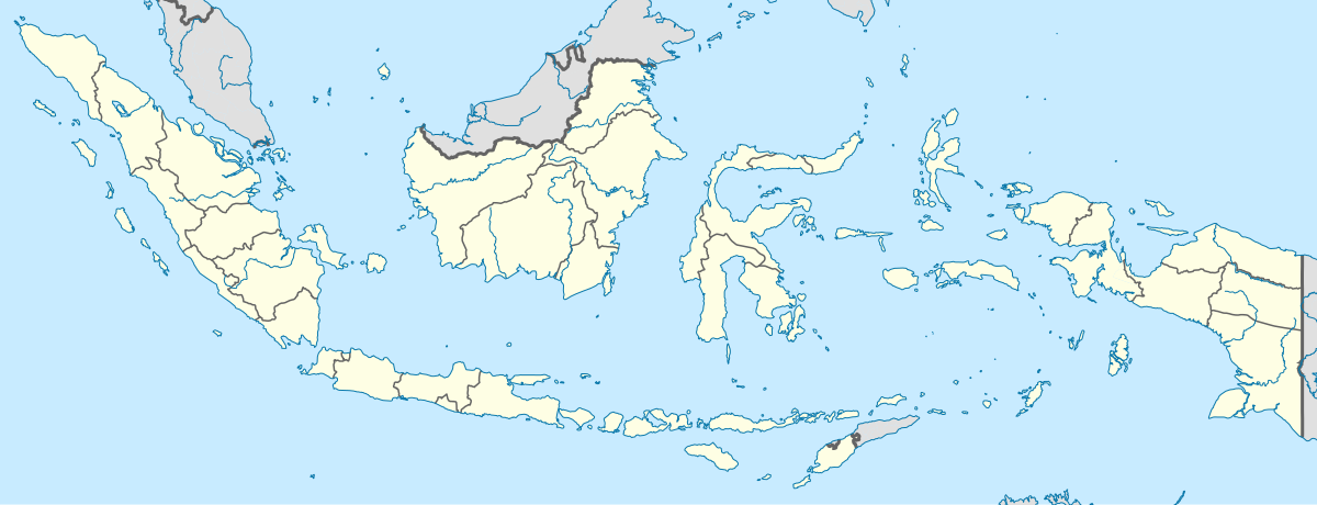
Size of this PNG preview of this SVG file: 800 × 307 pixels. Başqa çözüm: 320 × 123 pixels | 640 × 245 pixels | 1.024 × 393 pixels | 1.280 × 491 pixels | 2.560 × 981 pixels | 1.200 × 460 pixels.
Kerçek fayl (SVG faylı, nominal 1.200 × 460 piksel, fayl büyükligi: 739 KB)
Faylğa ait qısqa tarif
| Tasvir |
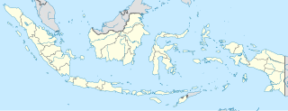
English: Location map of Indonesia.
Equirectangular projection. Stretched by 100.0%. Geographic limits of the map:
|
| Tarih | |
| Menba | Öz işi |
| Yaratıcı | Uwe Dedering |
| Other versions |
|
Litsenziyalama
I, the copyright holder of this work, hereby publish it under the following licenses:
This file is licensed under the Creative Commons Attribution-Share Alike 3.0 Unported license.
- Azatsıñız:
- paylaşuv – qopyaluv, dağıtuv ve iletüv
- remiks etüv – uyğunlaştıruv
- Bu şartlar astında:
- attribution – You must give appropriate credit, provide a link to the license, and indicate if changes were made. You may do so in any reasonable manner, but not in any way that suggests the licensor endorses you or your use.
- aynı şekilde paylaşuv – If you remix, transform, or build upon the material, you must distribute your contributions under the same or compatible license as the original.

|
Permission is granted to copy, distribute and/or modify this document under the terms of the GNU Free Documentation License, Version 1.2 or any later version published by the Free Software Foundation; with no Invariant Sections, no Front-Cover Texts, and no Back-Cover Texts. A copy of the license is included in the section entitled GNU Free Documentation License. |
İstedigiñiz lisansnı seçebilirsiñiz.
Faylnıñ keçmişi
Faylnıñ kerekli anki alını körmek içün tarihqa/saatqa basıñız.
| Tarih ve saat | Kiçik resim | En × boy | Qullanıcı | İzaat | |
|---|---|---|---|---|---|
| şimdiki | 15:54, 2022 s. dekabrniñ 4 | 1.200 × 460 (739 KB) | NordNordWest | upd | |
| 20:17, 2022 s. iyülniñ 2 | 1.200 × 460 (910 KB) | NordNordWest | upd | ||
| 20:21, 2013 s. iyünniñ 26 | 1.200 × 460 (854 KB) | NordNordWest | upd | ||
| 12:58, 2010 s. fevralniñ 18 | 1.200 × 460 (1,2 MB) | Uwe Dedering | {{Information |Description={{en|1=Location map of Indonesia. Equirectangular projection. Strechted by 100.0%. Geographic limits of the map: * N: 6.5° N * S: -11.5° N * W: 94.5° E * E: 141.5° E Made with Natural Earth. Free vector and raster map |
Fayl qullanıluvı
Bu 2 saifeler qullana bu fayldı:
Umumiy fayl qullanıluvı
Bu vikilerde bu fayldı qullana:
- ace.wikipedia.org qullanım
- af.wikipedia.org qullanım
- als.wikipedia.org qullanım
- an.wikipedia.org qullanım
- ar.wikipedia.org qullanım
- ast.wikipedia.org qullanım
View more global usage of this file.