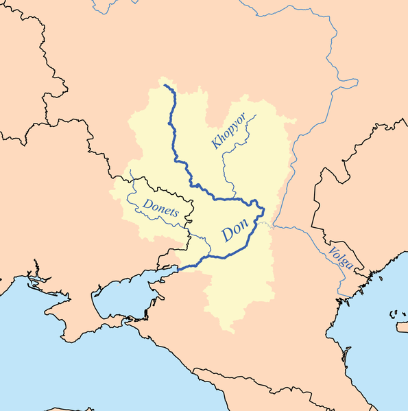
Fayl:Donrivermap.png

Bu baqıp çıquvnıñ büyükligi: 595 × 599 pixels. Başqa çözüm: 238 × 240 pixels | 477 × 480 pixels | 1.000 × 1.007 pixels.
Kerçek fayl (1.000 × 1.007 piksel, fayl büyükligi: 209 KB, MIME çeşiti: image/png)
Faylnıñ keçmişi
Faylnıñ kerekli anki alını körmek içün tarihqa/saatqa basıñız.
| Tarih ve saat | Kiçik resim | En × boy | Qullanıcı | İzaat | |
|---|---|---|---|---|---|
| şimdiki | 19:32, 2013 s. fevralniñ 2 |  | 1.000 × 1.007 (209 KB) | Kmusser | Upped resolution, added Khopyor |
| 23:15, 2006 s. sentâbrniñ 18 |  | 400 × 403 (66 KB) | Kmusser | This is a map of the Don and Donets rivers. I, Karl Musser, created it based on USGS data. {{self|cc-by-sa-2.5}} Category:Maps of rivers |
Fayl qullanıluvı
Bu saife qullana bu fayldı:
Umumiy fayl qullanıluvı
Bu fayl aşağıdaki başqa vikilerde qullanıla:
- af.wikipedia.org leyhasında qullanıluvı
- am.wikipedia.org leyhasında qullanıluvı
- ar.wikipedia.org leyhasında qullanıluvı
- arz.wikipedia.org leyhasında qullanıluvı
- ast.wikipedia.org leyhasında qullanıluvı
- be-tarask.wikipedia.org leyhasında qullanıluvı
- be.wikipedia.org leyhasında qullanıluvı
- bh.wikipedia.org leyhasında qullanıluvı
- bn.wikipedia.org leyhasında qullanıluvı
- bo.wikipedia.org leyhasında qullanıluvı
- bs.wikipedia.org leyhasında qullanıluvı
- ca.wikipedia.org leyhasında qullanıluvı
- ceb.wikipedia.org leyhasında qullanıluvı
- cs.wikipedia.org leyhasında qullanıluvı
- cy.wikipedia.org leyhasında qullanıluvı
- da.wikipedia.org leyhasında qullanıluvı
- de.wikipedia.org leyhasında qullanıluvı
- dsb.wikipedia.org leyhasında qullanıluvı
- en.wikipedia.org leyhasında qullanıluvı
- eo.wikipedia.org leyhasında qullanıluvı
- eo.wiktionary.org leyhasında qullanıluvı
- es.wikipedia.org leyhasında qullanıluvı
- et.wikipedia.org leyhasında qullanıluvı
- eu.wikipedia.org leyhasında qullanıluvı
- fa.wikipedia.org leyhasında qullanıluvı
Bu faylnıñ global qullanılğanını köster.
