Fayl:Denmark location map.svg

Size of this PNG preview of this SVG file: 703 × 600 pixels. Başqa çözüm: 281 × 240 pixels | 563 × 480 pixels | 900 × 768 pixels | 1.201 × 1.024 pixels | 2.401 × 2.048 pixels | 1.836 × 1.566 pixels.
Kerçek fayl (SVG faylı, nominal 1.836 × 1.566 piksel, fayl büyükligi: 435 KB)
Faylğa ait qısqa tarif
| Tasvir |
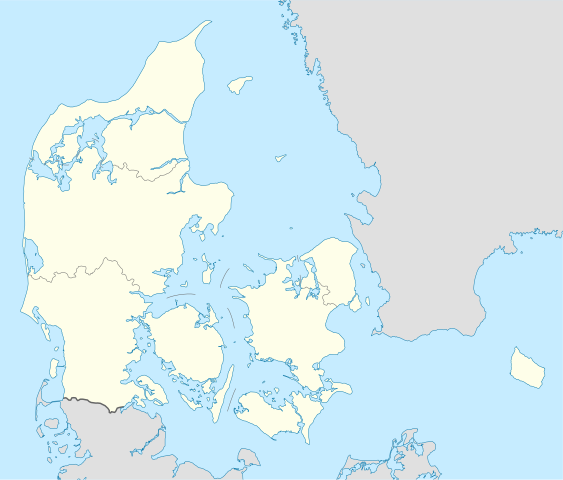
Deutsch: Positionskarte von Dänemark
Quadratische Plattkarte, N-S-Streckung 180 %. Geographische Begrenzung der Karte:
English: Location map of Denmark
Equirectangular projection, N/S stretching 180 %. Geographic limits of the map:
|
||
| Tarih | |||
| Menba | Öz işi, using United States National Imagery and Mapping Agency data | ||
| Yaratıcı | NordNordWest | ||
| Other versions | Derivative works of this file: Regenbogen location map.svg | ||
| SVG genesis |
|

Litsenziyalama
I, the copyright holder of this work, hereby publish it under the following licenses:

|
Permission is granted to copy, distribute and/or modify this document under the terms of the GNU Free Documentation License, Version 1.2 or any later version published by the Free Software Foundation; with no Invariant Sections, no Front-Cover Texts, and no Back-Cover Texts. A copy of the license is included in the section entitled GNU Free Documentation License. |
This file is licensed under the Creative Commons Attribution-Share Alike 3.0 Unported license.
- Azatsıñız:
- paylaşuv – qopyaluv, dağıtuv ve iletüv
- remiks etüv – uyğunlaştıruv
- Bu şartlar astında:
- attribution – You must give appropriate credit, provide a link to the license, and indicate if changes were made. You may do so in any reasonable manner, but not in any way that suggests the licensor endorses you or your use.
- aynı şekilde paylaşuv – If you remix, transform, or build upon the material, you must distribute your contributions under the same or compatible license as the original.
İstedigiñiz lisansnı seçebilirsiñiz.
Faylnıñ keçmişi
Faylnıñ kerekli anki alını körmek içün tarihqa/saatqa basıñız.
| Tarih ve saat | Kiçik resim | En × boy | Qullanıcı | İzaat | |
|---|---|---|---|---|---|
| şimdiki | 15:30, 2022 s. noyabrniñ 25 | | 1.836 × 1.566 (435 KB) | GrandEscogriffe | more correct north-south stretching |
| 18:57, 2008 s. avgustnıñ 25 |  | 1.836 × 1.479 (441 KB) | NordNordWest | size correction | |
| 08:53, 2008 s. iyülniñ 2 |  | 612 × 493 (434 KB) | NordNordWest | {{Information |Description= {{de|Positionskarte von Dänemark}} Quadratische Plattkarte, N-S-Streckung 170 %. Geographische Begrenzung der Karte: * N: 57.9° N * S: 54.3° N * W: 8.8° O * O: 15.4° O {{en|Location map of [[:en:Denmark|D |
Fayl qullanıluvı
Bu 2 saifeler qullana bu fayldı:
Umumiy fayl qullanıluvı
Bu vikilerde bu fayldı qullana:
- af.wikipedia.org qullanım
- ar.wikipedia.org qullanım
- az.wikipedia.org qullanım
- ba.wikipedia.org qullanım
- be-tarask.wikipedia.org qullanım
- Капэнгаген
- Гэрнінг
- Шаблён:Лякалізацыйная мапа Даніі
- Одэнсэ
- Лянгелян
- Фальстэр
- Стрэймай
- Сувурай
- Фуглёй
- Эстурой
- Сандой
- Кальсой
- Скувой
- Вагар
- Наўльсой
- Люйтля-Дуймун
- Віёй
- Свуйной
- Скаген
- Оргус
- Чэмпіянат Эўропы па гандболе сярод мужчынаў 2014 году
- Брэнбю
- Ольбарг
- Ранэрс
- Эсб’ерг
- Кольдынг
- Горсэнс
- Вайле
- Роскіле
- Гэльсынгёр
- Сылькебарг
- Нэствэд
- Фрэдэрысія
View more global usage of this file.