Africa
Eastern Africa
-
Burundi
-
Comoros
-
Djibouti
-
Eritrea
-
Ethiopia
-
Kenya
-
Madagascar
-
Malawi
-
Mauritius
-
Mayotte
-
Mozambique
-
Tanzania
-
Somalia
-
Uganda
Southern Africa
-
Lesotho
-
South Africa
-
Zambia
-
Zimbabwe
Central Africa
Northern Africa
Western Africa
-
Azawad
-
Benin
-
Burkina Faso
-
Cape Verde
-
Côte d'Ivoire
-
Gambia
-
Ghana
-
Guinea
-
Liberia
-
Mali
-
Mali without Azawad
-
Mauritania
-
Niger
-
Nigeria
-
Senegal
-
Sierra Leone
Americas
-
Americas
-
Northern North America
-
North America
-
Central America
-
South America
-
Southern South America
North America
-
Greenland
-
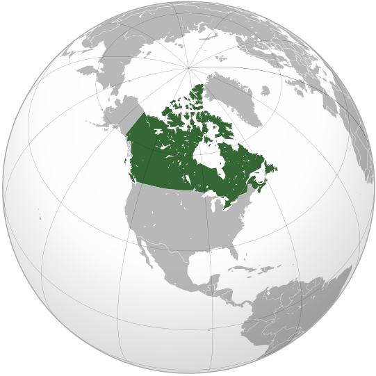
Canada
-
United States of America
-
Mexico
Central America
-
Guatemala
-
El Salvador
-
Honduras
-
Nicaragua
-
Costa Rica
-
Panama
Caribbean
-
Trinidad and Tobago
-
Cuba
-
Dominican Republic
-
Haiti
-
Jamaica
South America
Asia
East
-
East Asia
-
China
-
Japan
-
Mongolia
-
North Korea (excluding claimed)
-
South Korea (excluding claimed)
-
Jiangxi
-
Taiwan
-
Republic of China (including claimed)
-
Republic of Korea (including claimed)
-
Democratic People's Republic of Korea (including claimed)
-
Korea
Central
-
Central Asia
-
Kazakhstan
-
Tajikistan
-
Kyrgyzstan
-
Uzbekistan
Southeast
Bahasa Indonesia: Asia tenggara
South
(भारतीय उपमहाद्वीप)
Українська: Південна Азія.
-
South Asia
-
Afghanistan
-
Bangladesh
-
Bhutan
-
India
-
Maldives
-
Nepal
-
Pakistan
-
Sri Lanka
Western
Українська: Передня Азія.
-
Western Asia
-
Levant
-
Georgia
-
Georgia (with inset), showing breakaway states
-
Georgia (with inset), without breakaway states
-
Armenia
-
Azerbaijan
-
Nagorno-Karabakh Republic
-
Iran
-
Iraq
-
Israel
-
Jordan
-
Saudi Arabia
-
State of Palestine
-
Syria
-
Lebanon
-
Turkey
-
United Arab Emirates
Europe
-
Europe, Caucasus-Urals boundary
-
Europe, unclear boundary somewhere in the mid-Caucasus, suffering from edit-wars
-
Europe, Caucasus-Urals boundary, with state borders
-
Northern Europe
-
Southern Europe
-
Western Europe
-
Northwestern Europe
-
Mainland Europe
-
Latin Europe
-
Council of Europe
-
European Union
-
European Union with internal borders
-
Benelux
-
Visegrád Group
-
British Isles
-
Great Britain
-
Island of Cyprus
-
Iberia
Countries
-
Albania
-
Armenia
-
Azerbaijan
-
Belarus
-
Belgium
-
Bosnia and Herzegovina
-
Bulgaria
-
Republic of Cyprus
-
Czech Republic
-
Denmark
-
Finland
-
France
-
Georgia
-
Georgia (with inset), showing breakaway states
-
Georgia (with inset), without breakaway states
-
Germany
-
Iceland
-
Italy
-
Kazakhstan
-
Kosovo
-
North Macedonia
-
Montenegro
-
Netherlands
-
Norway
-
Northern Cyprus
-
Poland
-
Portugal
-
Romania
-
Russia
-
Serbia
-
Spain
-
Sweden
-
Switzerland
-
Turkey
-
United Kingdom
Oceania
-
Oceania
-
Australia-New Guinea
-
Australia
-
Fiji
-
New Zealand
-
Papua New Guinea
Intercontinental
-
The Americas
-
Afro-eurasia
-
Arctic
-
Antarctica
-
Kingdom of the Netherlands
-
Organization for Security and Co-operation in Europe
-
Eurasia
-
Eurasian Economic Union
-
Greater Middle East
-
Ibero-America
-
Middle East
-
North Atlantic Treaty Organization
-
Arab World
-
Arab League
-
Latin America
-
Anglo America
-
Franco America
-
Hispanic America
-
Shanghai Cooperation Organization
Historical
English: Unions, Organizations, Kingdoms, Empires
Español: Uniones, Organizaciones, Reinos, Imperios
Filipino: Mga Unyon, Organisasyon, Kaharian, Imperyo
Français : Unions, Organisations, Royaumes, Empires
हिन्दी: संघ, संगठन, राज्य, साम्राज्य व ऐतिहासिक देश
ქართული: გაერთიანებები, ორგანიზაციები, სამეფოები, იმპერიები
Tagalog: Mga Unyon, Organisasyon, Kaharian, Imperyo
Українська: Союзи, Організації, Королівства, Імперії
-
Almoravid Empire
-
Austro-Hungary
-
Aztec Empire
-
Aztec Empire (with dominance between Teozapotlan and Xoconochco)
-
Biafra
-
Benin (Separatist state in Nigeria)
-
Captaincy General of Chile
-
Chincha Country
-
Confederate States of America
-
Dominion of Pakistan (with Indian Controlled Kashmir)
-
Eurasian Economic Community
-
European Economic Community
-
Empire of Brazil
-
Federal Republic of Central America
-
First Mexican Empire
-
Frankish Empire
-
German Reich
-
German Reich (With Occupations)
-
Great Colombia
-
Granadine Confederation
-
Italian Empire
-
Japanese Empire
-
Inca Empire
-
Mughal Empire
-
New France
-
New Granada
-
Peru–Bolivia Confederation
-
Roman Empire
-
Russian Empire
-
Second Mexican Empire
-
Songhai Empire
-
Union of Soviet Socialist Republics
-
United Arab Republic
-
United Provinces of Central America
-
United States of Colombia
-
Viceroyalty of New Granada
-
Viceroyalty of New Spain
-
Viceroyalty of Peru
-
Viceroyalty of the Río de la Plata
-
Wilsonian Armenia
Subnationals
हिन्दी: उपराष्ट्रीय इकाईयाँ
| 


