Fayl:Brazil Labelled Map.svg

Size of this PNG preview of this SVG file: 681 × 600 pixels. Başqa çözüm: 273 × 240 pixels | 545 × 480 pixels | 872 × 768 pixels | 1.163 × 1.024 pixels | 2.325 × 2.048 pixels | 780 × 687 pixels.
Kerçek fayl (SVG faylı, nominal 780 × 687 piksel, fayl büyükligi: 400 KB)
| This image was created / taken by João Felipe C.S. |
| Tasvir |
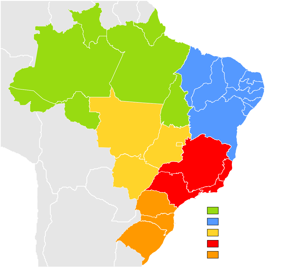
English: Brazil Labelled Map.
Português: Mapa Clicável do Brasil.
This W3C-unspecified vector image was created with Inkscape . |
||||||||
| Tarih | |||||||||
| Menba | Own work (Image:Brazil State Map.svg) | ||||||||
| Yaratıcı | Felipe Menegaz | ||||||||
| İzin (Faylnı yañıdan qullanuv) |
I, Felipe Menegaz, the copyright holder of this work, hereby publishes it under the following licenses:
This file is licensed under the Creative Commons Attribution-Share Alike 2.5 Generic, 2.0 Generic and 1.0 Generic license. Attribution: I, Felipe Menegaz
İstedigiñiz lisansnı seçebilirsiñiz. |
||||||||
| Other versions |
Derivative works of this file: |


Faylnıñ keçmişi
Faylnıñ kerekli anki alını körmek içün tarihqa/saatqa basıñız.
| Tarih ve saat | Kiçik resim | En × boy | Qullanıcı | İzaat | |
|---|---|---|---|---|---|
| şimdiki | 22:20, 2022 s. sentâbrniñ 11 | | 780 × 687 (400 KB) | Heitordp | Updated border between Acre and Amazonas |
| 11:35, 2018 s. iyülniñ 20 |  | 780 × 687 (400 KB) | Krauss | no solution, labels lost in Wikipedia | |
| 11:25, 2018 s. iyülniñ 20 |  | 780 × 687 (405 KB) | Krauss | Really labelled | |
| 18:19, 2013 s. oktâbrniñ 9 |  | 780 × 687 (400 KB) | Nyttend | Changing colors: my colorblindness makes it almost impossible to see the boundary between North and Northeast | |
| 15:29, 2011 s. oktâbrniñ 16 |  | 780 × 687 (400 KB) | TZ master | adding ISO 3166-2 codes and region names as classes | |
| 01:38, 2008 s. mayısnıñ 22 |  | 780 × 687 (400 KB) | Giro720 | Minimizando arquivo, especificando id, uso de folho de estilo. | |
| 16:59, 2007 s. dekabrniñ 1 |  | 780 × 687 (638 KB) | Felipe Menegaz | ||
| 17:51, 2007 s. iyünniñ 11 |  | 780 × 687 (638 KB) | Felipe Menegaz | {{User:João Felipe C.S/by}} {{Information |Description= {{en|Brazil Labelled Map.}} {{pt|Mapa Clicável do Brasil.}} ---- {{Inkscape}} |Source= Own work (Image:Brazil State Map.svg) |Date= June 11, 2007 |Author= [[User:João Felipe C.S|João Felipe | |
| 17:42, 2007 s. iyünniñ 11 |  | 780 × 687 (503 KB) | Felipe Menegaz | {{User:João Felipe C.S/by}} {{Information |Description= {{en|Brazil Labelled Map.}} {{pt|Mapa Clicável do Brasil.}} ---- {{Inkscape}} |Source= Own work (Image:Brazil State Map.svg) |Date= June 11, 2007 |Author= [[User:João Felipe C.S|João Felipe |
Fayl qullanıluvı
Bu 29 saifeler qullana bu fayldı:
- Akri
- Alagoas
- Amapa
- Amazonas
- Baiya
- Brazil
- Esperitu Santu
- Federal bölge (Brazil)
- Goyas
- Maranyan
- Matu Grosu
- Matu Grosu du Sul
- Minas Jerays
- Para (ştat)
- Paraiba
- Parana (ştat)
- Pernambuku
- Piaui
- Rio de Janeyro (ştat)
- Riu Grandi du Norti
- Riu Grandi du Sul
- Rondoniya
- Rorayma
- San Paulu (ştat)
- Santa Katarina
- Seara
- Serjipi
- Tokantins
- Şablon:Brazil ştatları
Umumiy fayl qullanıluvı
Bu vikilerde bu fayldı qullana:
- ace.wikipedia.org qullanım
- ar.wikipedia.org qullanım
- as.wikipedia.org qullanım
- avk.wikipedia.org qullanım
- ba.wikipedia.org qullanım
- be.wikipedia.org qullanım
- bg.wikipedia.org qullanım
- bn.wikipedia.org qullanım
- bxr.wikipedia.org qullanım
- cs.wikipedia.org qullanım
- cv.wikipedia.org qullanım
- da.wikipedia.org qullanım
- de.wikipedia.org qullanım
- Verwaltungsgliederung Brasiliens
- Fußballmeisterschaften der Bundesstaaten von Brasilien
- Wikipedia:Kartenwerkstatt/Archiv/2012-01
- Região Norte (Brasilien)
- Benutzer:Turíbio Branco
- Região Nordeste
- Região Sul
- Região Sudeste
- Região Centro-Oeste
- Fußballmeisterschaften der Bundesstaaten von Brasilien (Frauenfußball)
- Vorlage:Navigationsleiste Regionen in Brasilien
- diq.wikipedia.org qullanım
- el.wikipedia.org qullanım
- en.wikipedia.org qullanım
- Brazil
- Geography of Brazil
- Regions of Brazil
- State football leagues in Brazil
- Brazilian Athletics Confederation
- Brazilian football league system
- Template:Brazil Labelled Map
- Water supply and sanitation in Brazil
- Wikipedia:WikiProject Brazil/Cartography
- Irrigation in Brazil
- Water resources management in Brazil
- Template:Detailed map of Brazil
- Portal:Geography/Featured picture/2009, week 49
- Portal:Geography/Featured picture archive/2009
- Pre-salt layer
View more global usage of this file.