Fayl:Blank map of xmao-geoloc.svg

Size of this PNG preview of this SVG file: 512 × 323 pixels. Başqa çözüm: 320 × 202 pixels | 640 × 404 pixels | 1.024 × 646 pixels | 1.280 × 808 pixels | 2.560 × 1.615 pixels.
Kerçek fayl (SVG faylı, nominal 512 × 323 piksel, fayl büyükligi: 155 KB)
Faylğa ait qısqa tarif
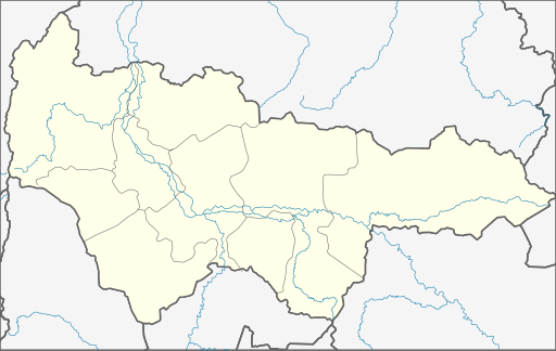
| Tasvir | Geolocation map for Khnaty-Mansi's Autonomous District of Yugra (Russia) |
| Tarih | |
| Menba | Own Draw |
| Yaratıcı | WWay, Deviritative work from Khanty-Mansiysky AO.png by СафроновАВ (Russian Wikipedia) |
| Other versions |
Derivative works of this file: |
Litsenziyalama
I, the copyright holder of this work, hereby publish it under the following license:
This file is licensed under the Creative Commons Attribution-Share Alike 3.0 Unported license.
- Azatsıñız:
- paylaşuv – qopyaluv, dağıtuv ve iletüv
- remiks etüv – uyğunlaştıruv
- Bu şartlar astında:
- attribution – You must give appropriate credit, provide a link to the license, and indicate if changes were made. You may do so in any reasonable manner, but not in any way that suggests the licensor endorses you or your use.
- aynı şekilde paylaşuv – If you remix, transform, or build upon the material, you must distribute your contributions under the same or compatible license as the original.
Faylnıñ keçmişi
Faylnıñ kerekli anki alını körmek içün tarihqa/saatqa basıñız.
| Tarih ve saat | Kiçik resim | En × boy | Qullanıcı | İzaat | |
|---|---|---|---|---|---|
| şimdiki | 21:03, 2010 s. noyabrniñ 29 | | 512 × 323 (155 KB) | Виктор В | Обрезка по координатам, стандартные цвета, дополнения на основе naturalearthdata.com |
| 01:26, 2010 s. sentâbrniñ 8 |  | 500 × 300 (8 KB) | Orange-kun | Code reduced | |
| 17:02, 2010 s. martnıñ 9 |  | 560 × 325 (23 KB) | Orange-kun | Reverted to version as of 20:39, 5 March 2010 Khanty-Mansia is the independent subject of Russia. Even trough it connects to Tyumen Oblast, we use geoloc for the subjects. | |
| 23:01, 2010 s. martnıñ 5 |  | 1.030 × 661 (82 KB) | Пакко | corr | |
| 22:50, 2010 s. martnıñ 5 |  | 1.030 × 661 (82 KB) | Пакко | better version | |
| 20:39, 2010 s. martnıñ 5 |  | 560 × 325 (23 KB) | Iguacu | standart colours | |
| 17:17, 2009 s. sentâbrniñ 24 |  | 560 × 325 (21 KB) | Orange-kun | {{Information |Description= Geolocation map for Khnaty-Mansi's Autonomous District of Yugra (Russia) |Source=Own Draw |Date=24\09\09 |Author=WWay |Permission= |other_versions= }} |
Fayl qullanıluvı
Bu 41 saifeler qullana bu fayldı:
- Agiriş
- Andra (şeer şeklinde qasaba)
- Barsovo (Hantı-Mansi muhtar bölgesi — Yugra)
- Beloyarskiy (şeer)
- Belıy Yar (Hantı-Mansi muhtar bölgesi — Yugra)
- Berözovo (Hantı-Mansi muhtar bölgesi — Yugra)
- Födorovskiy (Hantı-Mansi muhtar bölgesi — Yugra)
- Hantı-Mansiysk
- Kogalım
- Kommunistiçeskiy
- Kondinskoye (Hantı-Mansi muhtar bölgesi — Yugra)
- Kuminskiy
- Langepas
- Lugovoy (Hantı-Mansi muhtar bölgesi — Yugra)
- Lântor
- Malinovskiy (Hantı-Mansi muhtar bölgesi — Yugra)
- Megion
- Mejdureçenskiy (Hantı-Mansi muhtar bölgesi — Yugra)
- Mortka (Hantı-Mansi muhtar bölgesi — Yugra)
- Nefteyugansk
- Nijnevartovsk
- Novoagansk
- Nâgan
- Oktâbrskoye (Hantı-Mansi muhtar bölgesi — Yugra)
- Pionerskiy (Hantı-Mansi muhtar bölgesi — Yugra)
- Pokaçi
- Poykovskiy
- Priobye (Hantı-Mansi muhtar bölgesi — Yugra)
- Pıt-Yah
- Radujnıy (Hantı-Mansi muhtar bölgesi — Yugra)
- Sovetskiy (Hantı-Mansi muhtar bölgesi — Yugra)
- Surgut
- Talinka
- Tayojnıy (Hantı-Mansi muhtar bölgesi — Yugra)
- Uray
- Vısokiy (Hantı-Mansi muhtar bölgesi — Yugra)
- Yugorsk
- Zelenoborsk (Hantı-Mansi muhtar bölgesi — Yugra)
- İgrim
- İzluçinsk
- Şablon:Location map Rusiye Hantı-Mansi muhtar bölgesi — Yugra
Umumiy fayl qullanıluvı
Bu vikilerde bu fayldı qullana:
- af.wikipedia.org qullanım
- ar.wikipedia.org qullanım
- azb.wikipedia.org qullanım
- ba.wikipedia.org qullanım
- Ҡалып:ПозКарта Рәсәй Ханты-Манси автономиялы округы — Югра
- Ортъягун (Хант-Манси автономиялы округы — Югра)
- Верхнеказымский
- Ванзеват
- Нумто
- Казым (Хант-Манси автономиялы округы — Югра)
- Лыхма
- Пашторы
- Сосновка (Белоярский районы)
- Юильск
- Деминская
- Тутлейм
- Шайтанка (ауыл)
- Анеева
- Ванзетур
- Новинская
- Нерохи
- Усть-Манья
- Приполярный
- Хурумпауль
- Щекурья
- Ясунт
- Светлый (Хант-Манси автономиялы округы)
- Сосьва (Хант-Манси автономиялы округы)
- Верхненильдина
- Кимкьясуй
- Ломбовож
- Патрасуй
- Теги (ҡасаба)
- Пугоры
- Устрём
- Елушкино (Кондинское районы)
- Алтай (Кондинское районы)
- Болчары
- Дальний (Кондинское районы)
- Ильичёвка
- Кама (Кондинское районы)
- Катыш (Кондинское районы)
- Леуши
- Леушинка
- Лиственичный (Кондинское районы)
- Мулымья
- Назарово (Кондинское районы)
- Никулкина
- Сатыга
- Сотник (Кондинское районы)
View more global usage of this file.