Fayl:Belarus location map.svg

Size of this PNG preview of this SVG file: 672 × 600 pixels. Başqa çözüm: 269 × 240 pixels | 538 × 480 pixels | 861 × 768 pixels | 1.148 × 1.024 pixels | 2.295 × 2.048 pixels | 1.626 × 1.451 pixels.
Kerçek fayl (SVG faylı, nominal 1.626 × 1.451 piksel, fayl büyükligi: 326 KB)
Faylğa ait qısqa tarif
| Tasvir |
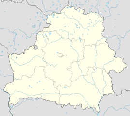
Deutsch: Positionskarte von Weißrussland
Quadratische Plattkarte, N-S-Streckung 170 %. Geographische Begrenzung der Karte:
English: Location map of Belarus
Equirectangular projection, N/S stretching 170 %. Geographic limits of the map:
|
||
| Tarih | |||
| Menba |
Öz işi (Original text: own work, using United States National Imagery and Mapping Agency data)
|
||
| Yaratıcı | NordNordWest | ||
| SVG genesis | This locator map was created with Adobe Illustrator by NordNordWest, and with Inkscape.
|

Litsenziyalama
I, the copyright holder of this work, hereby publish it under the following licenses:

|
Permission is granted to copy, distribute and/or modify this document under the terms of the GNU Free Documentation License, Version 1.2 or any later version published by the Free Software Foundation; with no Invariant Sections, no Front-Cover Texts, and no Back-Cover Texts. A copy of the license is included in the section entitled GNU Free Documentation License. |
This file is licensed under the Creative Commons Attribution-Share Alike 3.0 Unported license.
- Azatsıñız:
- paylaşuv – qopyaluv, dağıtuv ve iletüv
- remiks etüv – uyğunlaştıruv
- Bu şartlar astında:
- attribution – You must give appropriate credit, provide a link to the license, and indicate if changes were made. You may do so in any reasonable manner, but not in any way that suggests the licensor endorses you or your use.
- aynı şekilde paylaşuv – If you remix, transform, or build upon the material, you must distribute your contributions under the same or compatible license as the original.
İstedigiñiz lisansnı seçebilirsiñiz.
Faylnıñ keçmişi
Faylnıñ kerekli anki alını körmek içün tarihqa/saatqa basıñız.
| Tarih ve saat | Kiçik resim | En × boy | Qullanıcı | İzaat | |
|---|---|---|---|---|---|
| şimdiki | 12:33, 2016 s. aprelniñ 2 | | 1.626 × 1.451 (326 KB) | Nzeemin | Колодищи removed, Медвежье-Саньково added. |
| 17:39, 2016 s. aprelniñ 1 |  | 1.626 × 1.451 (326 KB) | Nzeemin | Minsk contours updated from OSM | |
| 16:36, 2016 s. aprelniñ 1 |  | 1.626 × 1.451 (320 KB) | Nzeemin | Lakes update from GSHHS | |
| 14:27, 2016 s. aprelniñ 1 |  | 1.626 × 1.451 (232 KB) | Nzeemin | Rivers update from GSHHS | |
| 19:19, 2013 s. noyabrniñ 20 |  | 1.626 × 1.451 (166 KB) | NordNordWest | border removed | |
| 18:30, 2010 s. avgustnıñ 30 |  | 1.628 × 1.454 (163 KB) | Виктор В | Попытка №2 | |
| 18:28, 2010 s. avgustnıñ 30 |  | 1.628 × 1.454 (163 KB) | Виктор В | +реки | |
| 17:20, 2008 s. sentâbrniñ 5 |  | 1.628 × 1.454 (202 KB) | NordNordWest | size correction | |
| 16:09, 2008 s. iyülniñ 4 |  | 814 × 727 (197 KB) | NordNordWest | ||
| 15:59, 2008 s. iyülniñ 4 |  | 814 × 684 (196 KB) | NordNordWest | {{Information |Description= {{de|Positionskarte von Weißrussland}} Quadratische Plattkarte, N-S-Streckung 160 %. Geographische Begrenzung der Karte: * N: 56.4° N * S: 51.1° N * W: 22.9° O * O: 33.0° O {{en|Location map of [[:en: |
Fayl qullanıluvı
Bu 10 saifeler qullana bu fayldı:
Umumiy fayl qullanıluvı
Bu vikilerde bu fayldı qullana:
- af.wikipedia.org qullanım
- an.wikipedia.org qullanım
- ar.wikipedia.org qullanım
- av.wikipedia.org qullanım
- az.wikipedia.org qullanım
- Minsk
- Orşa
- Brest
- Şablon:Yer xəritəsi Belarus
- Fanipol
- Mogilyov
- Neris çayı
- Çeçersk
- Zaslavl
- Qrodno
- Oginski kanalı
- Vitebsk
- Qomel
- Lida
- Pinsk
- Qorki (Belarus)
- Bobruysk
- Mozır
- Lepel
- Soliqorsk
- Novopolotsk
- Baranoviçi
- Borisov (şəhər)
- Minsk Beynəlxalq Hava Limanı
- Molodeçno
- Müqəddəs Sofiya kafedralı (Polotsk)
- Müqəddəs Boris və Qleb kilsəsi
- Müqəddəs Simon və Elena kilsəsi
- Belarus Dövlət Opera və Balet Teatrı
- Müqəddəs Mixail kilsəsi (Sınkoviçi)
- Müqəddəs Fransis Xavier kafedralı (Qrodno)
- Yanka Kupala adına teatr
- ba.wikipedia.org qullanım
View more global usage of this file.