Fayl:BaltiyskPillau 05-2017 img07 aerial photo.jpg
Size of this preview: 800 × 533 pixels. Başqa çözüm: 320 × 213 pixels | 640 × 427 pixels | 1.024 × 683 pixels | 1.280 × 853 pixels | 2.560 × 1.707 pixels | 4.111 × 2.741 pixels.
Kerçek fayl (4.111 × 2.741 piksel, fayl büyükligi: 8,14 MB, MIME çeşiti: image/jpeg)
| Tasvir |
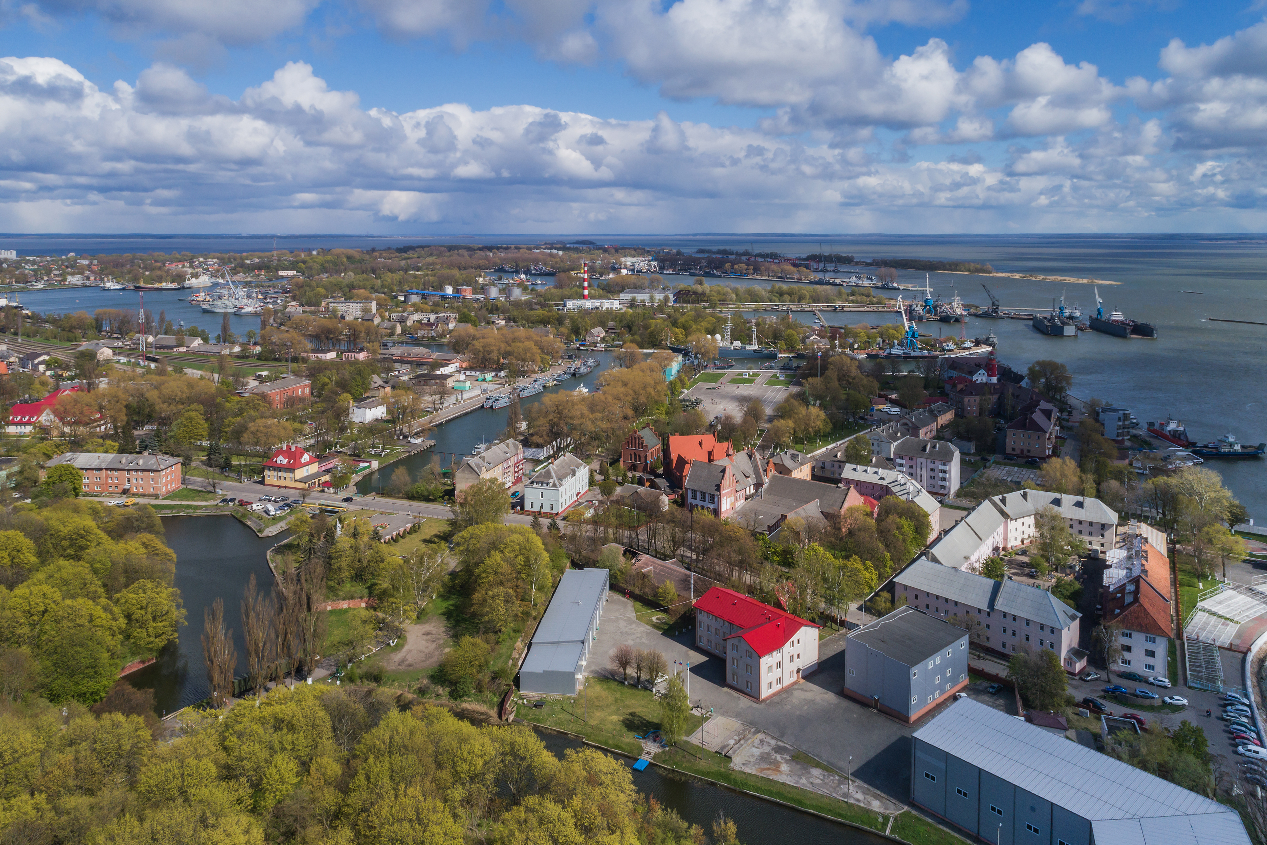
English: Aerial photo of Baltiysk formerly Pillau / Kaliningrad Oblast (Russia).
Deutsch: Luftaufnahme von Baltijsk ehem. Pillau / Kaliningrader Gebiet (Russland).
Русский: Аэрофотосъёмка города Балтийска / Калининградская область (Россия). |
| Tarih | |
| Menba | Öz işi |
| Yaratıcı | A.Savin |
| İzin (Faylnı yañıdan qullanuv) |
.svg) Just attribute the author: «A.Savin, Wikipedia»; if you have questions — Telegram, or e-mail to wikiphotospace@gmail.com..svg) Просто укажите в качестве автора: «А.Савин, Википедия»; если есть вопрос — телеграм, или эл.почта на wikiphotospace@gmail.com. Kennzeichnen Sie einfach als Autor: «A.Savin, Wikipedia»; falls Sie Fragen haben — Telegram, oder E-Mail an wikiphotospace@gmail.com.
Thank you. |
| Camera location | | View this and other nearby images on: OpenStreetMap |
|---|
Litsenziyalama
| Copyleft: This work of art is free; you can redistribute it and/or modify it according to terms of the Free Art License. You will find a specimen of this license on the Copyleft Attitude site as well as on other sites. |
Faylnıñ keçmişi
Faylnıñ kerekli anki alını körmek içün tarihqa/saatqa basıñız.
| Tarih ve saat | Kiçik resim | En × boy | Qullanıcı | İzaat | |
|---|---|---|---|---|---|
| şimdiki | 12:35, 2017 s. iyünniñ 30 | | 4.111 × 2.741 (8,14 MB) | A.Savin | {{User:A.Savin/F |Description= {{en|Aerial photo of Baltiysk formerly Pillau / Kaliningrad Oblast (Russia).}} {{de|Luftaufnahme von Baltijsk ehem. Pillau / Kaliningrader Gebiet (Russland).}} {{ru|Аэрофотосъёмка города Балтийс... |
Fayl qullanıluvı
Bu saife qullana bu fayldı:
Umumiy fayl qullanıluvı
Bu vikilerde bu fayldı qullana:
- ar.wikipedia.org qullanım
- ast.wikipedia.org qullanım
- az.wikipedia.org qullanım
- be-tarask.wikipedia.org qullanım
- be.wikipedia.org qullanım
- bg.wikipedia.org qullanım
- ca.wikipedia.org qullanım
- ceb.wikipedia.org qullanım
- ce.wikipedia.org qullanım
- cs.wikipedia.org qullanım
- da.wikipedia.org qullanım
- de.wikipedia.org qullanım
- el.wikipedia.org qullanım
- en.wikipedia.org qullanım
- en.wikivoyage.org qullanım
- eo.wikipedia.org qullanım
- es.wikipedia.org qullanım
- et.wikipedia.org qullanım
- fr.wikipedia.org qullanım
- fy.wikipedia.org qullanım
- he.wikipedia.org qullanım
- io.wikipedia.org qullanım
- it.wikipedia.org qullanım
- kk.wikipedia.org qullanım
- ko.wikipedia.org qullanım
- lt.wikipedia.org qullanım
- nl.wikipedia.org qullanım
- nn.wikipedia.org qullanım
- no.wikipedia.org qullanım
- os.wikipedia.org qullanım
- ru.wikipedia.org qullanım
- ru.wikinews.org qullanım
- ru.wikivoyage.org qullanım
- sh.wikipedia.org qullanım
- sk.wikipedia.org qullanım
- sl.wikipedia.org qullanım
- sr.wikipedia.org qullanım
- tr.wikipedia.org qullanım
- tt.wikipedia.org qullanım
- uk.wikipedia.org qullanım
- www.wikidata.org qullanım
- zh-min-nan.wikipedia.org qullanım
- zh.wikipedia.org qullanım