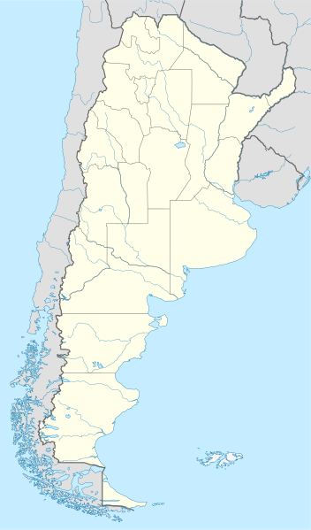
Fayl:Argentina location map.svg

Size of this PNG preview of this SVG file: 352 × 599 pixels. Başqa çözüm: 141 × 240 pixels | 282 × 480 pixels | 451 × 768 pixels | 602 × 1.024 pixels | 1.204 × 2.048 pixels | 1.418 × 2.412 pixels.
Kerçek fayl (SVG faylı, nominal 1.418 × 2.412 piksel, fayl büyükligi: 1,03 MB)
Faylğa ait qısqa tarif
.svg)
.svg)

|
This map has been made or improved in the German Kartenwerkstatt (Map Lab). You can propose maps to improve as well.
|
Litsenziyalama
I, the copyright holder of this work, hereby publish it under the following licenses:

|
Permission is granted to copy, distribute and/or modify this document under the terms of the GNU Free Documentation License, Version 1.2 or any later version published by the Free Software Foundation; with no Invariant Sections, no Front-Cover Texts, and no Back-Cover Texts. A copy of the license is included in the section entitled GNU Free Documentation License. |
This file is licensed under the Creative Commons Attribution-Share Alike 3.0 Unported license.
- Azatsıñız:
- paylaşuv – qopyaluv, dağıtuv ve iletüv
- remiks etüv – uyğunlaştıruv
- Bu şartlar astında:
- attribution – You must give appropriate credit, provide a link to the license, and indicate if changes were made. You may do so in any reasonable manner, but not in any way that suggests the licensor endorses you or your use.
- aynı şekilde paylaşuv – If you remix, transform, or build upon the material, you must distribute your contributions under the same or compatible license as the original.
İstedigiñiz lisansnı seçebilirsiñiz.
Faylnıñ keçmişi
Faylnıñ kerekli anki alını körmek içün tarihqa/saatqa basıñız.
| Tarih ve saat | Kiçik resim | En × boy | Qullanıcı | İzaat | |
|---|---|---|---|---|---|
| şimdiki | 15:26, 2022 s. avgustnıñ 11 | | 1.418 × 2.412 (1,03 MB) | Janitoalevic | Reverted to version as of 02:18, 25 May 2021 (UTC) |
| 00:27, 2022 s. mayısnıñ 9 |  | 1.418 × 2.412 (1,51 MB) | Buttons0603 | Reverted to version as of 20:33, 29 January 2021 (UTC) see below | |
| 02:18, 2021 s. mayısnıñ 25 |  | 1.418 × 2.412 (1,03 MB) | MinervaAustral | Reverted to version as of 03:37, 24 November 2018 (UTC) | |
| 20:33, 2021 s. yanvarniñ 29 |  | 1.418 × 2.412 (1,51 MB) | Buttons0603 | Reverted to version as of 13:13, 23 November 2018 (UTC) There is already a version with the Falklands in white at File:Argentina location map (+Falkland).svg for when such a map is needed. | |
| 03:37, 2018 s. noyabrniñ 24 |  | 1.418 × 2.412 (1,03 MB) | Cacen Gymraeg | Reverted to version as of 01:43, 6 November 2017 (UTC). Added claim territories (neutral point of view) | |
| 13:13, 2018 s. noyabrniñ 23 |  | 1.418 × 2.412 (1,51 MB) | Mr. James Dimsey | Reverted to version as of 23:25, 9 October 2015 (UTC) | |
| 01:43, 2017 s. noyabrniñ 6 |  | 1.418 × 2.412 (1,03 MB) | Janitoalevic | Added Fontana and Plata Lake. | |
| 01:37, 2017 s. noyabrniñ 6 |  | 1.418 × 2.412 (1,02 MB) | Janitoalevic | Fixed provincial and international borders. | |
| 21:36, 2016 s. martnıñ 25 |  | 1.418 × 2.412 (997 KB) | Janitoalevic | Added all the Disputed Territories | |
| 19:00, 2016 s. martnıñ 21 |  | 1.418 × 2.412 (994 KB) | Gustavo Girardelli | Detalles. |
.svg)
Fayl qullanıluvı
Bu 2 saifeler qullana bu fayldı:
Umumiy fayl qullanıluvı
Bu vikilerde bu fayldı qullana:
- af.wikipedia.org qullanım
- Comodoro Rivadavia
- Mar del Plata
- Bariloche
- La Plata
- Villa General Belgrano
- FIFA Sokker-Wêreldbekertoernooi in 1978
- Balcarce
- Sarmiento
- Sjabloon:Liggingkaart Argentinië
- Monserrat, Buenos Aires
- Aconcagua
- Ojos del Salado
- Los Toldos
- Coloradorivier (Argentinië)
- Rawson
- Ministro Pistarini Internasionale Lughawe
- an.wikipedia.org qullanım
- ar.wikipedia.org qullanım
- ast.wikipedia.org qullanım
- Buenos Aires
- Abbott
- Agote (Buenos Aires)
- La Plata
- Partido de La Plata
- Abasto (La Plata)
- Ángel Etcheverry
- Arturo Seguí
- City Bell
- Joaquín Gorina
- José Hernández (Buenos Aires)
- Manuel B. Gonnet
- Ringuelet
- Tolosa (Buenos Aires)
- Villa Elvira
- El Peligro (La Plata)
- San Carlos (Buenos Aires)
- Ríu de la Plata
- Mendoza (Arxentina)
- Costa de Reyes
- Santa Cruz (Catamarca)
- Las Tejas
View more global usage of this file.