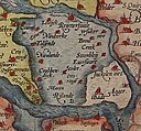
Fayl:1580 Zelandicarum v Deventer.jpg

Size of this preview: 800 × 591 pixels. Başqa çözüm: 320 × 237 pixels | 640 × 473 pixels | 1.024 × 757 pixels | 1.280 × 946 pixels | 2.666 × 1.971 pixels.
Kerçek fayl (2.666 × 1.971 piksel, fayl büyükligi: 1,71 MB, MIME çeşiti: image/jpeg)
Faylnıñ keçmişi
Faylnıñ kerekli anki alını körmek içün tarihqa/saatqa basıñız.
| Tarih ve saat | Kiçik resim | En × boy | Qullanıcı | İzaat | |
|---|---|---|---|---|---|
| şimdiki | 21:57, 2007 s. dekabrniñ 2 |  | 2.666 × 1.971 (1,71 MB) | Joopr | {{Information |Description=title=Zelandicarum Insularum Exactissima Et Nova Descriptio, Auctore D. Iacobo A Daventria;size=34x47cm |Source=http://www.orteliusmaps.com/stocklists/12.html |Date=1580 |Author=Ortelius naar v Deventer |Permission= |other_versi |
Fayl qullanıluvı
Bu saife qullana bu fayldı:
Umumiy fayl qullanıluvı
Bu vikilerde bu fayldı qullana:
- af.wikipedia.org qullanım
- arz.wikipedia.org qullanım
- bg.wikipedia.org qullanım
- cv.wikipedia.org qullanım
- de.wikipedia.org qullanım
- en.wikipedia.org qullanım
- es.wikipedia.org qullanım
- et.wikipedia.org qullanım
- fr.wikipedia.org qullanım
- fy.wikipedia.org qullanım
- he.wikipedia.org qullanım
- hu.wikipedia.org qullanım
- it.wikipedia.org qullanım
- ko.wikipedia.org qullanım
- lbe.wikipedia.org qullanım
- lb.wikipedia.org qullanım
- mk.wikipedia.org qullanım
- mwl.wikipedia.org qullanım
- nl.wikipedia.org qullanım
- no.wikipedia.org qullanım
- os.wikipedia.org qullanım
- pl.wikipedia.org qullanım
- pt.wikipedia.org qullanım
- ro.wikipedia.org qullanım
- ru.wikipedia.org qullanım
- ru.wikinews.org qullanım
- sah.wikipedia.org qullanım
- scn.wikipedia.org qullanım
- sl.wikipedia.org qullanım
View more global usage of this file.


